The Haute route, Chamonix to Zermatt John Race owner of the Northwest Mountain School offered me a spot to Shadow a Haute route trip March 27-April 1st. The group was going to ski the Valle Blacne the first day which I was going to miss out on because imideatly before this trip I had already agreed to work. a 8 Denali Prep trip for Alpine Ascents and wasn't going to be able to make it in time. I spoke to John about this and he said it would be fine if I skied the Valle Banche with the first day of the next group before I would head home. Well my Denali Prep trip ended one day early, giving me a full 30 hours in town to pack and hang out with Rebecca before flying to Geneva and taking a shuttle to Chamonix.

Pete Keane was co-guiding the trip with John Race. Pete is an awesome guy and owner of Timber Line Mountain guides (Famous for guiding mt Hood). This shot was taken right before we picked up our clients to take the #1 bus (which was actually free) at 7:45am to Argentiere so we could take the Grand Montets Tram with a gain of 7713 ft/23651 Meter to an elevation of 10,692ft/3269 meters .
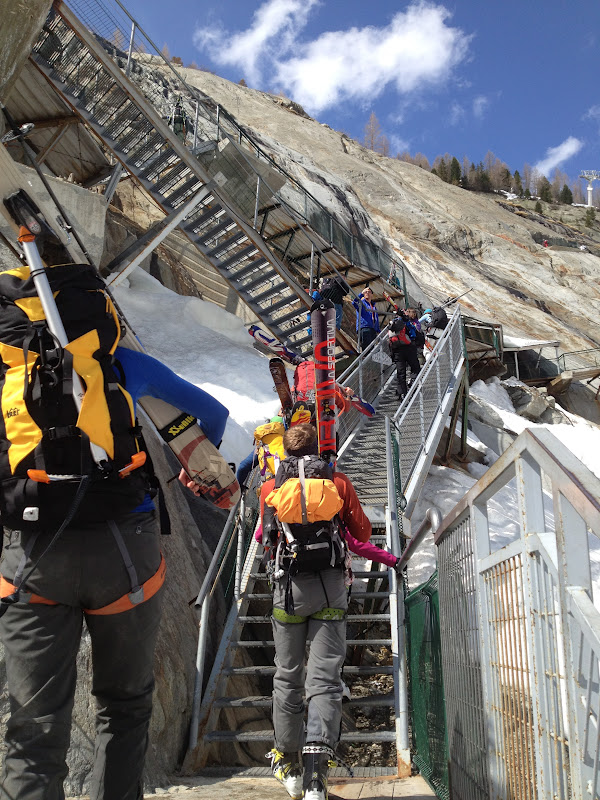
The view as we walked out of the tram station looking down on the Col des Grand Montets 10,580ft/3225m. We had to talk down a cool but exposed stair case (you can see it on the bottom right).
Looking across the Valley at the big climb up the Col du Chardonnet at 10,895ft/ 3321meters. The bottom of the climb is at 8,464ft/2580m on the Glacier d'Argentiere. Here a few Euro skiers (notice the mirco packs doing the first part of the Haute route starting the descent down to the NE from the Col des Grand Montents down the Glacier des Rogons.
We are standing on the Glacier d'Argentiere looking up at the Col des Grand Montets which is on the left hand side of the rocky skyline, We skied the line between the two ice falls down the Glacier des Rogons. This is a very popular ski tour by it self and skiers are able to ski this almost all the way back down to the Valley floor.
This is our group approaching the bottom of the climb to the Col du Chardonnet. It is either a very steep ski track (ski crampons mandatory) which John Race referred to as "Grade VI skinning or a booter. While the bottom of the climb is quite steep, the angle eases out dramatically as you get on the Glacier du Chardonnet. It was a boot track in our case and we put boot crampons on, shouldered our skis and took out our ice axes for a few hundred feet.
Looking up at the North face of Les Droites, named number 99 of Gaston Rebufett's famous book 100 finest routes in the Mont Blanc Range.
Lowering clients down the Col Du Chardonnet. It is 75meter of 60-70 degree neve. You can do two 40m rappels but we just lowered clients down tieing our two 40m ropes together. At the bttom of the lower there is a nice mellow ski descent down the Glacier de Saleina.
Our group transitioning at the bottom of our ski run down the Glacier de Salenia
Skiing up the Glacier de Saleina heading for the steep snowing pass on the skyline. This gap is called the Fenetre De Saleina and is quite steep. We short roped out clients up the 150ft climb and had conditions been any firmer we would have had to pitch it out and not move together.
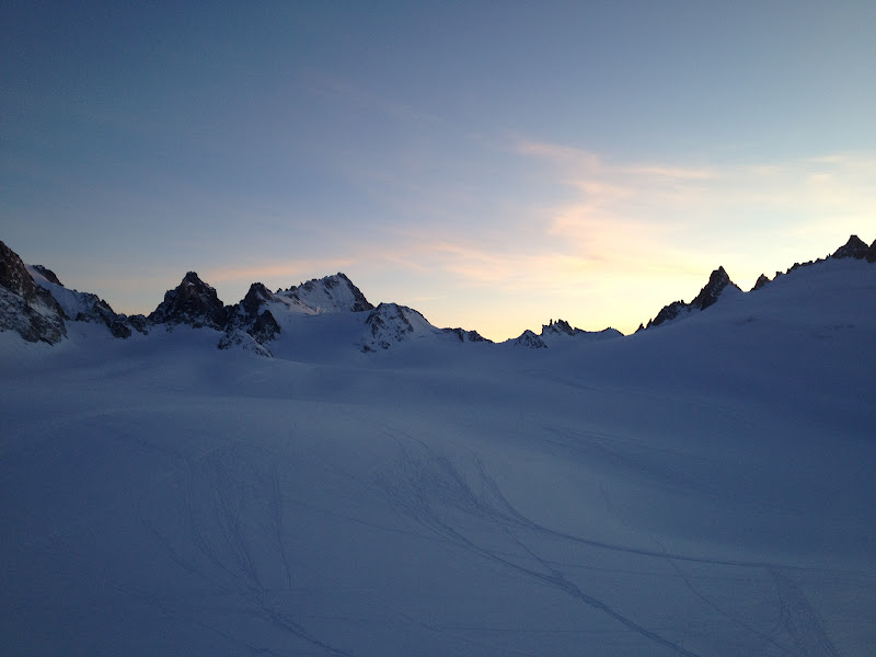
On the Other side of the Fenetre de Saleina is the Plateau du Trient on the Glacier du Trient. It is a long gentle ski down over 2km to the Trient hut
The view taken inside the Trient hut looking out across the Plateau du Trient and were we came from.
Inside the Hut
Well I basically blew it and didn't take any pictures on our descent, but I'll fill you in a little. We skied down the Glacier du Trient which had one slightly exciting side slip above some crevasses but it wasn't too bad. We then booted over the Dol des Ecandies 9,163ft/2793 with crampons on and ice axes out. Before making the 6 km descent down to and through the ski resort Relais d'Arpette to the town Champex 4,799ft/1486m a descent of 4364ft. The above picture is our group walking through the town of Champex to the location where we are going to catch our taxi to Le Chable where we are hoping to catch the tram up to Verbier and above that the Mont Fort Hut.
Our group on the taxi to Le Chable (800m)
The taxi meeting location in Champex
In the Swiss town of Chable you take the tram up to the town of Verbier. Verbier is actually four resorts all side by side, it is 30% taller than Whistle-Blackcomb and 3 times as wide, holy cow its huge!!!! We took the tram up. For only 4 more Euros we could get an all day pass and ski the rest of the day at Verbier so nearly everyone did. It was killer corner skiing with HUGE descents.
John Race point out where the Mt. Fort Hut was and telling our group the last tram up to the upper mountain where you could ski down (on-piste mind you) to the Mont Fort hut was at 4:30. This seamed super obvious but the Verbier ski resort was so huge it was easy to get to far away from the hut to be able to make it in time.
The view from the Mont Fort Hut
Me standing on the top lift at Verbier, just to the right of my head is the Matterhorn. It looked so far away I couldn't believe we were going to ski all the way over to it. Mont Blanc in the other direction was also starting to look pretty far away. These two mountains that mark the start and end point for the Haute route really give the scale of how long this famous ski mountaineering traverse really is
After Spending the night at the Mont Fort hut 8,061ft/ 2457m we got an early start which began with this skin over the Col de Le Chaux 9,645ft/ 2940m. The first part of the skin is on piste.
John Race at the Col de La Chaux
Skiing down the small glacier on the other side of the Col de La Chaux
Our group skiing up toward the Col de Momin
Me at the Col de Momin, you can see Mont Blanc in the background, its the tallest mountain second to the end from the left.
After a short descent, we begin he climb on the Glacier du Grand Desert. The peak on the right is RosaBlanche (10,944/ 3336m) and we tagged the summit and skied down just twenty feet from the top.
Me on the summit of RosaBlance, you can see the Matterhorn in the distance just above my head.
Mont Blanc in the other direction, looking back into France
After a sweet ski descent off RosaBlanche we had a short skin before starting our descent down the Glacier de Prafleuri to the Prafleuri hut. This section had awesome fall line turns mixed with traversing side hilling. This section would also be a nightmare during high avalanche danger or poor visibility.
In case you didn't guess because of all the tracks we are right above the Prafleuri hut, We skied down the left side of this photo. The col in the right center is the Col des Roux (2804m) and the start to the next day.
Looking up at some of the terrain we just came down on the Prafleuri Glacier.

The Prafleuri Hut
Our group inside the Prafleuri hut
Dessert in the Prafleuri hut, the food had been quite good I just didn't take any photos until now.
The following day after crossing over the Col des Roux we had one of the more notorious sections of the Haute route. A 6km side hill descent with occasional side steeping and skating traversing far above (at least at the start) the Lac des Dix. conditions were firm making this section even harder for people and there were very few turns on this descent.
After skiing down to the far South end of the Lake we began the climb up over the Pass du Chat to gain the edge of the Glacier de Cheilon.
Skinning toward the Pass du Chat.
A group of three female Italians who we would see every day of the rest of the trip. They all had Dynafit packs something you dont see as much in the USA. We are getting into the highest part of the Swiss Alps now. You can start to see some of the big terrain in the background through the clouds.
The view of Mt Blanc de Cheilon from the hut.
The Cabane des Dix (9606ft/ 2928m) our home for the night
Myself and one of the clients hanging out before going for a 2000ft ski tour in the afternoon with super light packs. We skied down a peak called La Luette. A cool looking peak named Ptes de Tsena Refien that looks fun to climb.
Pete Keane and the rest of our group inside the cabana des Dix.
A proshki (I am pretty sure this is spelled incorrectly), an excellent lunch that I ate on 3 different days, it is mostly potatoes with some bacon, egg, cheese and tomato in it.
Looking down from the top of our 2000ft ski descent of La Luette (11,640ft/ 3548m) back down to the Dix hut. You can actually see the Dix hut on the small rock out cropping up and just left of center.
Getting ready to drop in from La Luette (11,640ft/ 3548m)
There was a Italian rando club with 80 members present, they were doing a circit that shared much of the tail end of the Haute route, whoever they went Arolla to Arolla. There present really gave a more populated feel to the Haute route.
Look at La Luette (up and left) with the Glacier de la Luette and the hut on the rock out cropping that the finger of shade is pointing too.
Our group skinning up the Glacier de Tsena Refien on our way to the Passage de la Serpentine
Me on our high point of the Haute route on a short side trip to the top of Pigne d'Arolla 12,434ft/ 3,790m. This was one of our colder days. You can see the Matterhorn in the background.
Making the ski descent of Pigne d'Arolla
A short side slipping section moving down the Glacier de Piece, there is a large ice fall of to the lookers right. It was impressive to ski beside. At this point we are only about 200m above the Vignettes hut, our next home for the night.
Walking out the spectacular ridge to te Vignettes hut (3160m). If these hut were in the USA there would be a concrete side walked with fences, This hut sits at an extremely exposed position. Now the bathroom is in the main hut building, unfortunately someone slipped going to the old bathroom and died, just to give you an idea of exposure.
Pete Keane walking up to the Vignettes hut
Me hanging out in the Vignettes hut
More good food
Better Deserts!!!!
The Vignettes hut had the best boot drying area in a green house effect type area.
The next day our group skinning up the Glacier du Mont Collon toward the Col de Eveque, Once at the col we made a super nice fall line descent down the Haut glacier d'Arolla, it was one of the better descents of the trip. We did have to ski through an ice fall in the glacier which is always memorable, but this one wasn't that bad.
After skiing down the Haute glacier d'Arolla we headed back up a mellow 700ft climb toward the Col Du Mt. Brule
You can see the obvious snow finger that we will have to boot crampon up for. This col was one of the taller but mellower boot cramponing sections. We all moved together and I never considered pitching this section out.
On the Col de Mt. Brule, with the Haut glacier d'Arolla in the background. The peak in the background is La Vierge (3232m)
On the ski descent down from the Col de Mt. Brule down the Haut glacier Tsa de Tsan. This was another excellent descent with some of the best views of the trip so far. off to our left with large peaks and huge hanging glaciers. The col you can see in this photo is the Col de Valpelline (3562m) and our last climb of the trip, this is over a 4000ft day so most of the group is getting tried. at least it is gradual but it is LONG.
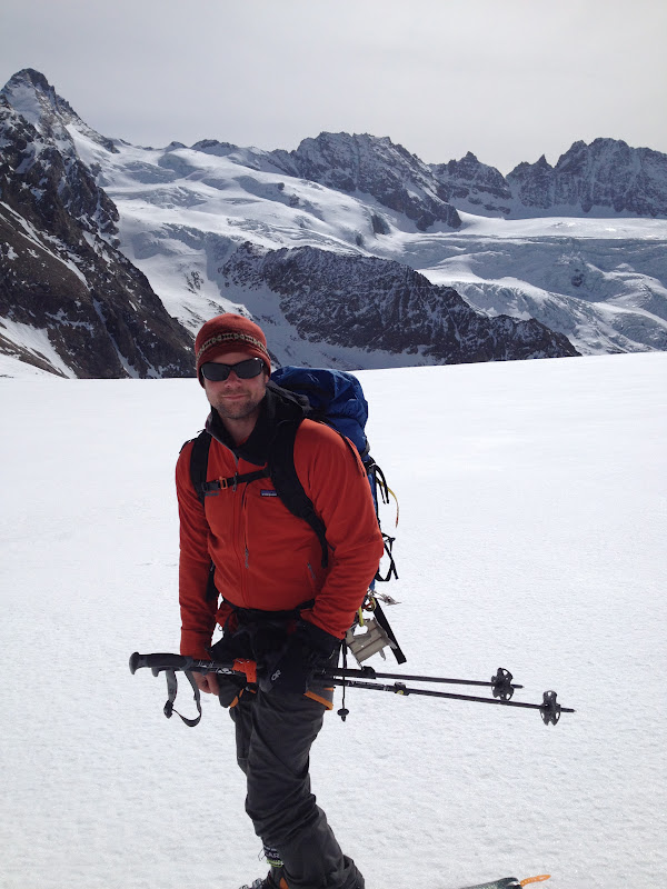
Me with some spectacular senerary of the Haute route in the background.
Our group skinning up to the Col de Valpelline
Our group skinning up to the Col de Valpelline
Looking back at the Col de Mt. Brule and rest of teh Haut Glacier de Tsa Tsan where we came from.
This was supposed to be a photo but it ended up being a funny short video, with the Matterhorn on the left
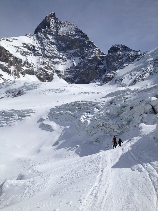
Me with the Matterhorn above me, I was freaking out and so excited, this was absolutely amazing, and the Matterhorn is WAY bigger than I was expecting, no wonder it was the last major peak to be climbed in the Alps.
Our group skiing down the Stockjiletscher (you can tell we are in the German speaking part of Switzerland now) glacier below the Matterhorn. An interesting note the Matterhorn is called Cervin in Switzerland and on the Swiss topo maps.
This was a truely amazing descent that took over 2.5 hours with non stop amazing views!!!!
Now our group is skiing down the Tiefmattenglescher below the NW face of the Matterhorn, this was certainly one of the best ski descents of my life and lasted almost 3 hours.
Our group traversing around one ice fall and below another on the Tiefmattengletscher.
Amazing views during the long descent, this photo was taken below the ice fall on the Tiefmattengletscher. Below this we descending onto the Zmuttgletscher. During a steep section a client took a fall which was pretty scary but because of the nice soft spring snow conditions they where fine, but it got our hearts racing,
Our group after transferring from the Tiefmattengletscher and now skiing down the Zmuttgletscher, After 6k of good fall line descending we had 7km of side hill down hill traversing, with occasional fall line turns. The views of the Matterhorn are spectacular. This section takes longer than you think.
Taking a photo looking back up at the Matterhorn (Cervin), after the long side hill section you ski down through a ski resort for about 20 minutes and end at the bottom in Zermatt. There are no private cars allowed in Zermatt, only taxis and delivery vehicles.
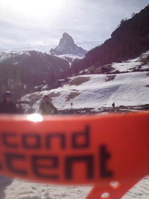
Me walking through Zermatt after just completing the Haute route. Life is good......... The Haute route is an incredible journey traveling a total of around 120km through three countries from Chamonix and Mont Blanc to Zermatt and the Matterhorn, Utilizing two bus/taxis/ and at least 7 trams (often multiple at one time). I had high expectations for the Haute route which it more than delivered. The terrain is huge and the navigation for those unprepared could be nightmarish.
Our group walking through the streets of Zermatt
After we walked our group to there hotel we had around 1 hour before we had to catch our train back to Chamonix so we could ski the Valle Blanche the next day. I went shopping for Rebecca and John and Pete were craving a hamburger so we went to McDonalds in the central square of Zermatt.